Hollis Burnham keeps his drafting table by the south window of an office above Rankin's Hardware on Bay View Street in Camden, Maine. The window looks out over the inner harbor and, beyond it, the outer ledges that have furnished him with subject matter for thirty-five years.
He is sixty-three years old. He learned the trade from his father, who learned it from a NOAA hydrographer named Walter Cleaves who came home to Camden in 1947 and never went back to Washington.
Burnham draws inshore cruising charts for a small list of commercial buyers, mostly Maine sailing schools, three island ferry operators, and the harbormaster's office in Rockland. He sells perhaps four hundred sheets a year, at $48 each.
The math does not really work. He says so himself. He keeps going because he doesn't know what else to do and because, he says, his charts are better than the alternatives for the specific waters they cover.
He is probably right.
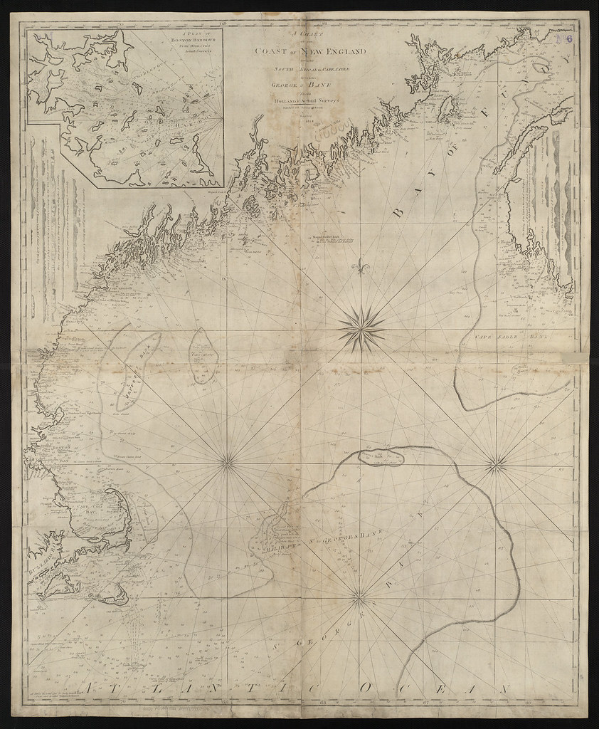
A NOAA chart of Penobscot Bay covers, at its largest published scale, an area roughly twenty miles east-to-west. Burnham's chart of the same bay is published at three times that scale and shows, hand-rendered, every named ledge, mooring field, kelp bed, and crab pot concentration that he has personally rowed past in the last decade.
He revises each chart annually. The revision involves a small open boat, a Garmin handheld GPS, a clipboard, and what he calls his "squint sheet," a printed proof of the previous edition onto which he marks changes in red ballpoint.
In May of 2026 he spent eleven days on the water in a 14-foot Lincolnville skiff. He logged 287 sounding observations, twelve new private moorings, and the disappearance of a wooden dock at Owl's Head that had been there since at least 1968.
Back at the table, he transferred the corrections into Adobe Illustrator, where the chart lives as a single layered file of 41 layers and roughly 19,000 individual paths.
He learned Illustrator in 1998 from a manual he bought at the Borders bookstore in Bangor.
Before that he drew everything with pen and ink on Mylar overlays. The hand-drawn editions, which he printed until 2003, are now collected by a small number of people who consider them the most beautiful charts produced in twentieth-century America. Burnham finds this both gratifying and slightly absurd.
He says that the digital workflow is, on balance, better. The corrections are easier. The reproduction is more faithful. He misses, he says, only the smell of the ink and the way a stroke felt when it was right.
The customers buy the charts for three reasons. The first is detail at scale. The second is local accuracy, particularly with regard to private aids to navigation that NOAA does not chart. The third is the laminated finish, which Burnham has done since 2007 at a small printer in Ellsworth.
Sailing schools like the laminates because students can mark them up with grease pencil and wipe them clean.
Burnham has no apprentice. He had one for two years, a young woman from Brunswick who had studied cartography at the University of Maine, but she left in 2022 for a salaried position at Esri in Redlands, California.
He does not blame her.
He thinks the trade will end with him, at least in Maine. He says this without melancholy. He has watched other small trades end and he understands that a thing ending is not the same as a thing dying. The charts will still exist. People will still use them, probably, for another twenty or thirty years, until the last laminated copy is too faded to read.
On the morning we spoke, in late April, Burnham was working on the 2026 edition of his Muscongus Bay chart. The Illustrator file was open on a 27-inch monitor, zoomed to 400 percent on the area around Hog Island. He was adjusting the position of a ledge marker by what looked, to an outsider's eye, like half a pixel.
He said the marker had been off by three meters in the previous edition.
Three meters, he said, was the difference between a boat and a hole in a boat.
He invited the visitor to come back in October, when the next edition would be at the printer in Ellsworth and he would, he said, have a little more time to talk.
When asked what would happen to the Illustrator files when he stopped, he said he hadn't decided. He thought perhaps the Penobscot Marine Museum would take them. He had not yet asked.
He closed Illustrator at 4:15 in the afternoon and went down the stairs to walk to the harbor and look at the water before supper.
Filed under