Calum Pereira holds a Royal Yachting Association Yachtmaster Ocean certificate and has delivered yachts across the Atlantic eleven times. He is not, by his own admission, a romantic about traditional methods. He uses chartplotters. He uses AIS. He uses, when offshore, a satellite link that gives him weather routing twice a day.
He also believes that any skipper who cannot fix a position by hand bearings in fewer than two minutes is, in his phrase, "renting their navigation from the satellites."
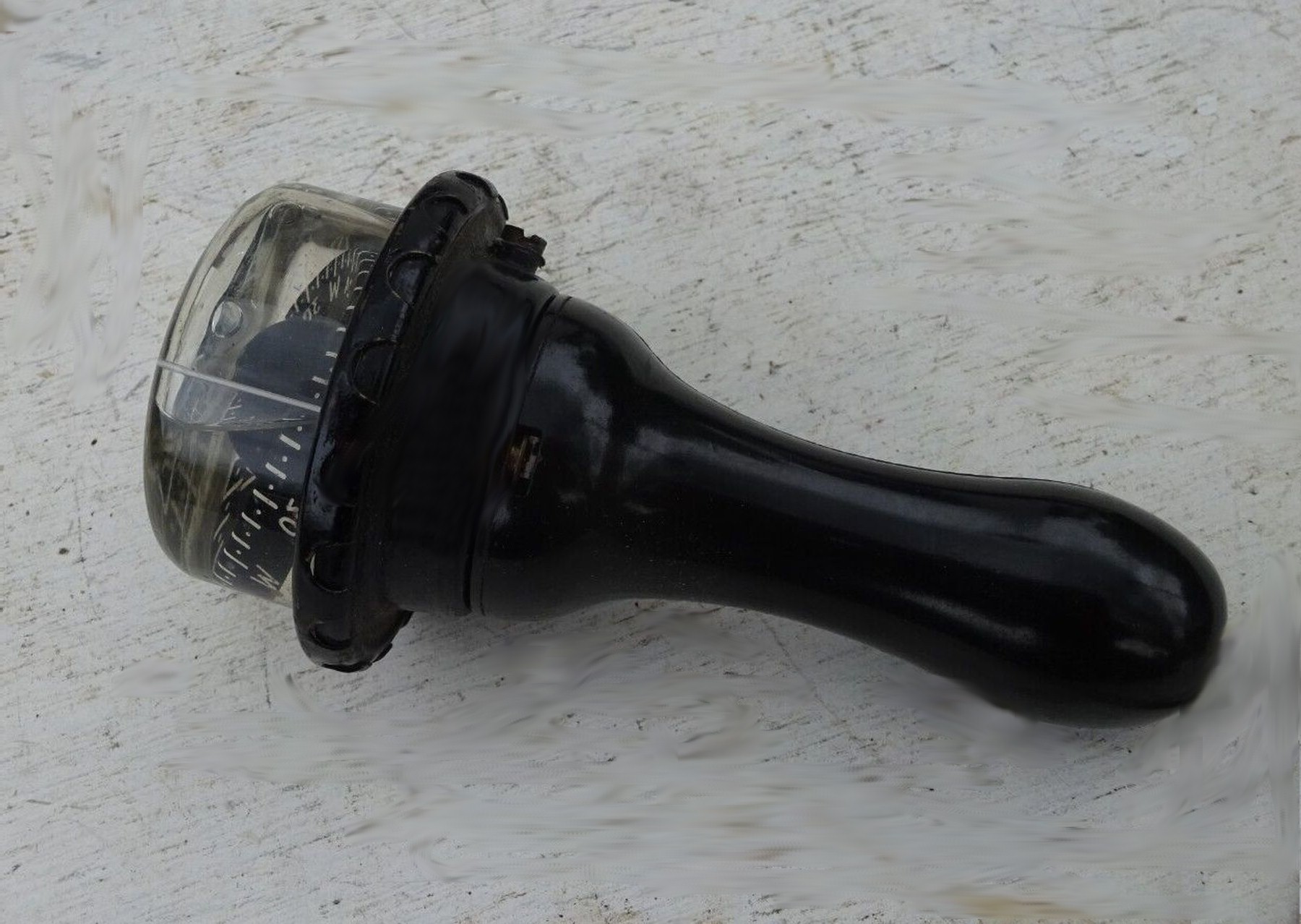
In May of 2026 he ran a four-day pilotage course out of La Trinité-sur-Mer on the south Brittany coast, aboard a chartered 38-foot Beneteau. Six students. One Plastimo Iris 50 hand-bearing compass each. A paper chart of the Quiberon Bay, SHOM 7141, on the saloon table.
The chartplotter was deliberately switched off for the duration of each daysail.
On the first morning, in calm water off the entrance to Le Crouesty, Pereira asked each student to take a single bearing on the Pen Bron lighthouse. He timed them. The fastest was 22 seconds. The slowest, who had owned the same compass for nine years, took 48 seconds and gave a bearing 11 degrees off the truth.
The error, Pereira said, was simple. The student was sighting through the prism without ensuring the compass was level. A hand-bearing compass is a sensitive instrument. Tilt it five degrees and you will read five degrees of error or more, depending on the latitude.
He spent the rest of the morning teaching them to hold the instrument at eye level with both elbows tucked against the ribs, to breathe out before sighting, and to wait until the card had settled completely before reading it.
By the afternoon the slow student was taking bearings in 14 seconds and within one degree of accuracy.
The technique is older than the students' grandfathers. It was taught at every merchant marine academy in the world from roughly 1880 to the introduction of differential GPS in the 1990s. It is still taught, but, Pereira says, increasingly as a museum piece.
He treats it as a daily tool.
The course covered the three-bearing fix, the running fix, the bearing-and-distance fix, the danger bearing, and the use of a transit, which is the line formed when two charted landmarks line up exactly. The transit, Pereira told the class, is the most underused piece of free navigation information in modern yachting.
On day two, off the île de Houat, he demonstrated by lining up a chimney on the island with a transmitter mast behind it and running the boat down the line for half a mile. The boat held position over the ground to within fifteen meters by the plotter, which he checked after the run was over.
No GPS was needed during the run.
On day three, in poor visibility north of Belle-Île, he had each student plot a four-bearing fix every fifteen minutes for two hours. The fixes were inscribed on the paper chart in pencil with the time and the initials of the student.
Two of the fixes were obviously wrong, with cocked-hat triangles the size of a small village. Pereira had the students work out, by inspection of their own bearings, which of the three bearings had been the bad one and why.
In one case the bad bearing had been taken on a buoy mistaken for the lighthouse behind it. In the other, a student had inadvertently held the compass over a metal stanchion.
The lessons were practical and unsentimental. Pereira did not say that GPS was bad. He said that GPS was a tool and that the hand-bearing compass was another tool, and that a skipper who knew only one had only half a kit.
He also said, on the last evening over a glass of Muscadet at the marina café, that he had once, in 2014, lost all electronics on a delivery from Falmouth to the Azores when a lightning strike took out the masthead instruments. He had navigated the last 480 miles by sextant, hand-bearing compass, and dead reckoning.
He made landfall at Faial within four miles of his planned waypoint.
He does not tell this story to impress anyone. He tells it because, he said, it was the only time in his career that the old skills had to do the work alone, and he wants the people he teaches to know that the old skills are still capable of doing the work alone, if asked.
The students left on the afternoon ferry to Quiberon. Two of them ordered new Plastimo compasses on the way home.
Pereira packed the chart away, refolded along its existing creases, and put it back in the locker above the chart table where it had lived for the four days.
He said he would run the course again in September.