The chart was rolled in a brown paper tube at the back of a wardrobe in a small terraced house on Matheson Road in Stornoway. The house had belonged to a retired Caledonian MacBrayne second officer named Murdo MacLeod, who died in November 2025 at the age of 91.
His daughter Catriona, clearing the house in February, found the tube. She brought it to the Stornoway Historical Society and from there it came, in March, to the desk of Eilidh Maciver at the University of the Highlands and Islands.
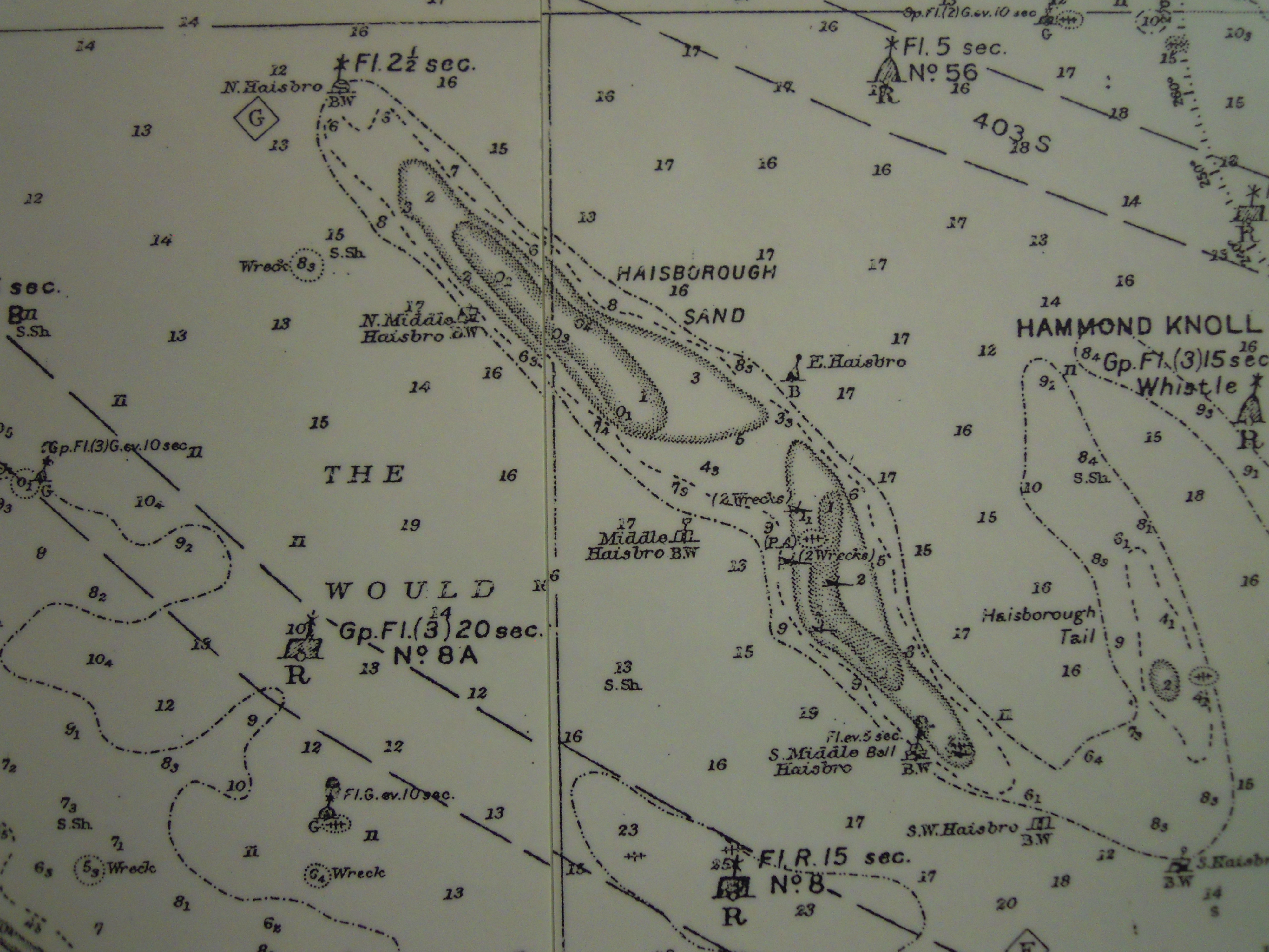
Maciver, a marine historian by training, recognized the chart at once. It was Admiralty Chart 2722, Hebrides Sheet 4, published 1903, surveyed by Lieutenant W. H. Beresford of HMS Research in 1898.
The paper was foxed at the edges but the engraved interior was intact. The chart covered the eastern coast of Lewis from Tiumpan Head to Loch Erisort, including the Eye Peninsula and the entrance to Stornoway harbour.
Maciver decided to compare the 1903 chart to the modern Admiralty chart of the same waters, 1794, edition 18, corrected to 2025. The project occupied her for the better part of a year.
The first surprise was how little had changed at sea. The depths shown by Beresford in 1898 agreed with modern soundings to within half a fathom in nearly every place where modern surveys existed. Beresford's leadline work, conducted from a 28-foot pulling boat with a crew of six over the course of seven weeks, was, by any reasonable standard, accurate.
The second surprise was how much had changed on land.
The 1903 chart shows a stone pier at Garrabost, on the south shore of Broad Bay, that has not existed since at least 1962. It shows a salmon bothy at the head of Loch a Tuath that was demolished in 1947. It shows a kelp drying station near Bayble that is now a holiday cottage.
These features were charted because they served as visual marks for vessels approaching the harbour. The pier at Garrabost, for example, was a transit mark for the safe entry to Broad Bay from the north.
Modern charts show none of these things. They show only what is there now: navigation lights, a few harbour walls, the outline of the modern road.
Maciver argues, in a paper now in draft for the journal Mariner's Mirror, that the loss of the older shore features from charts is not merely a question of currency but of cultural information. A 1903 chart records a coastline as a working landscape. A 2025 chart records it as a navigational surface.
Both are useful. Both are partial.
The most interesting divergence concerned the position of the coast itself. North of Tiumpan Head, the modern chart shows the shoreline approximately twenty-two meters further inland than the 1903 chart.
Maciver consulted the British Geological Survey records, which indicate that the cliffs along that section of coast have been retreating at an average of roughly 18 centimetres per year due to wave erosion. Over 123 years, that is 22 meters.
The chart, in other words, was right when it was drawn and the modern chart is right now. The cliff has simply moved.
This is the kind of thing that does not appear in chart corrections. The Admiralty does not issue Notices to Mariners about cliffs retreating slowly. The information is incorporated, eventually, when the chart is resurveyed, which happens on a cycle of decades for most British coasts and longer for the Outer Hebrides.
Maciver located only one place where the 1903 chart was actually wrong. A small isolated rock, charted by Beresford as drying 0.6 meters at low water, appears in modern surveys to dry at 1.2 meters and to be approximately twelve meters east of its 1903 position.
Either Beresford made an error or the rock has, in some sense, moved.
The most likely explanation is that Beresford's position was taken by sextant angle to two shore landmarks that have since been demolished, and that the modern position is, in any case, more accurate. The drying height discrepancy is probably a question of the chart datum used in 1898, which Maciver is still working to reconstruct.
The chart is now in the collection of the Stornoway Historical Society, in a flat archival drawer beside seven other charts from the same period. Catriona MacLeod was offered, and accepted, a digital scan of her father's chart in exchange for the donation.
She hung the scan in the kitchen of her own house in Point.
Maciver's paper, when it is published, will include the full comparison of the 1903 and 2025 charts side by side. She expects it to appear in the autumn 2026 issue of Mariner's Mirror.
She is, she says, in no particular hurry.